
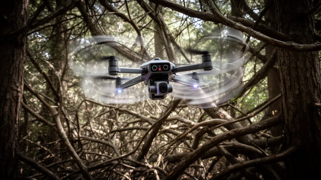
Durham University Drone Tech Unlocks Safer Autonomous Flight
Researchers from Durham University have successfully developed a groundbreaking drone navigation system known as ‘CORTO-Planner,’ a significant technological leap designed to empower autonomous aircraft to navigate complex, cluttered environments at high speeds without compromising safety or efficiency. As the demand for autonomous aerial vehicles increases across logistics, disaster response, and infrastructure inspection, the ability for these drones to compute obstacle-free paths in real-time has emerged as a primary engineering hurdle. The CORTO-Planner system addresses this critical bottleneck by optimizing path-finding algorithms to operate effectively within the tight constraints of high-speed aerial flight.
The Engineering Challenge: Speed vs. Safety
For autonomous aircraft, the primary challenge in navigation has historically been the tension between computational speed and environmental awareness. To navigate safely at high velocities, a drone must process massive amounts of sensory data—such as LiDAR or camera feeds—and calculate a collision-free trajectory in milliseconds. Existing solutions often struggle with the ‘compute bottleneck,’ where the time taken to process complex spatial environments exceeds the window available for real-time steering. This latency often forces drones to either fly at reduced speeds or risk collisions in high-density environments like urban centers or dense forests.
CORTO-Planner mitigates these risks by prioritizing efficient constraint-based optimization. Rather than processing the entirety of a mapped environment at high resolution, the system utilizes a sophisticated approach to map out safe trajectories dynamically. By breaking down the navigation problem into a series of manageable, high-priority safety constraints, the algorithm allows the drone to react to sudden obstacles—such as birds, branches, or unexpected moving objects—with minimal delay. This provides a level of agility that mirrors the flight patterns of biological entities like birds of prey, which can navigate dense vegetation at high speeds.
Inside the CORTO-Planner Architecture
At the core of the CORTO-Planner system is a focus on mathematical efficiency. The research team at Durham University focused on streamlining the trajectory generation process. Traditional path-planners often rely on iterative processes that can get stuck in ‘local minima,’ where the drone identifies a path that is not globally optimal or is computationally deadlocked.
CORTO-Planner leverages a novel optimization framework that ensures the system consistently produces valid, flyable paths even in highly constrained spaces. By pre-defining safe operational boundaries (or constraints), the system essentially creates a ‘virtual corridor’ that the drone can traverse confidently. This architecture ensures that the flight controller is always receiving the most optimized path data, reducing the onboard CPU load compared to legacy algorithms that perform exhaustive real-time re-mapping.
Transforming Industries: From Delivery to Rescue
The real-world implications for this technology are expansive. In the logistics sector, the ability to operate at higher speeds means faster, more reliable last-mile delivery. In high-speed, high-density zones, every kilometer per hour gained while maintaining safety is a net benefit to the efficiency of the entire supply chain. However, the impact may be most profound in Search and Rescue (SAR) operations.
During disaster response, time is the most valuable resource. Search and Rescue drones often need to explore collapsed structures, deep forests, or unstable environments where human teams cannot safely tread. The ability of a drone to fly autonomously at high speed through these ‘unstructured’ environments—without requiring a pilot to manually navigate every turn—could drastically reduce the time taken to locate survivors. CORTO-Planner provides the robustness needed for these life-saving missions where environmental unpredictability is the norm.
The Future of Regulatory Integration
Beyond technical performance, the safety aspect of CORTO-Planner is key to its adoption. Aviation regulators, such as the Federal Aviation Administration (FAA) and the European Union Aviation Safety Agency (EASA), have been historically cautious about autonomous flight over populated areas. One of the primary requirements for ‘Beyond Visual Line of Sight’ (BVLOS) certification is a proven, fail-safe obstacle avoidance mechanism.
By providing a consistent, mathematically verifiable method for collision avoidance, Durham’s research offers a framework that could help satisfy these stringent regulatory safety standards. As the algorithm matures, it could serve as a foundational element in the development of future autonomous traffic management systems, where high-speed drones share airspace with manned aircraft, requiring ultra-reliable, real-time collision avoidance capabilities.
FAQ: People Also Ask
Q: What does CORTO-Planner stand for?
A: CORTO-Planner is a specialized navigation system developed at Durham University, focusing on ‘Constraint-based Optimization’ for real-time autonomous pathfinding. It is designed to maximize safety in high-speed flight.
Q: How does CORTO-Planner differ from standard drone GPS navigation?
A: Standard GPS navigation provides location data but does not account for local obstacles. CORTO-Planner acts as a low-level intelligence system that manages collision avoidance and path adjustments in real-time, allowing the drone to see and avoid objects while navigating.
Q: Will this technology be available for consumer drones?
A: While currently in the research and development phase, systems like CORTO-Planner are often eventually licensed or adapted into software development kits for drone manufacturers, potentially appearing in high-end commercial and industrial drones in the future.
Q: What is the main benefit for industrial sectors?
A: The main benefit is increased operational efficiency. By allowing drones to fly faster without risking damage to the aircraft or property, industries can perform infrastructure inspections, environmental monitoring, and logistics deliveries more quickly and cost-effectively.


Related Posts