
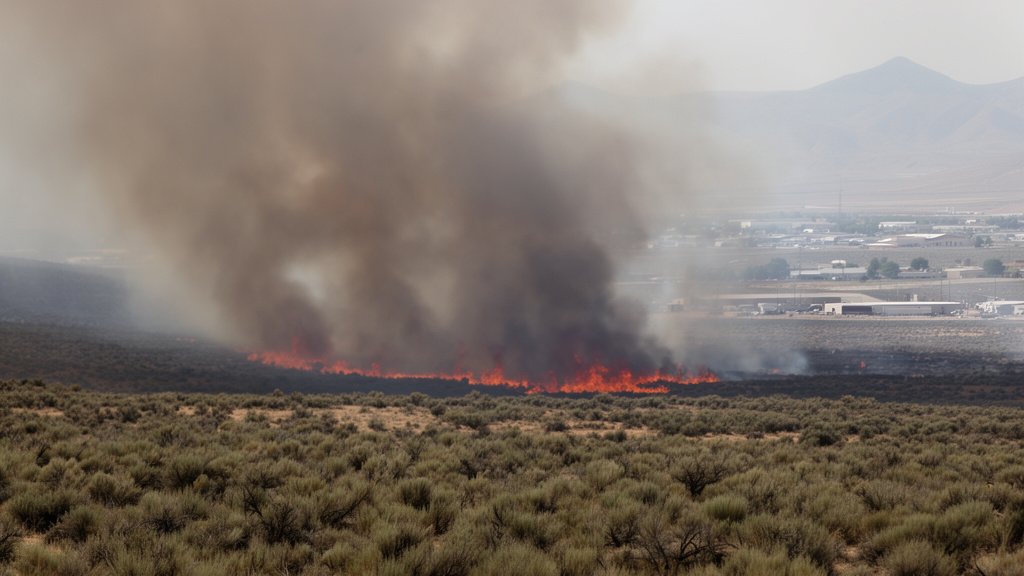
Widemouth 2 Fire Hits 36,438 Acres; Fillmore On Alert
The Widemouth 2 Fire has officially surpassed 36,438 acres, intensifying its push toward the town of Fillmore, Utah, as incident command teams struggle against erratic, high-velocity winds that have hindered containment progress. Emergency responders have escalated the alert level for residents as the blaze continues to advance through dry brush and timber, marking one of the most significant fire events in the region this season.
Key Highlights
- Current Size: The Widemouth 2 Fire has officially scorched 36,438 acres.
- Impending Threat: The fire is actively moving north, placing the town of Fillmore, Utah, in the path of the encroaching front.
- Environmental Factors: High winds and arid, difficult terrain are currently outpacing firefighting efforts.
- Emergency Status: Local authorities have implemented increased alert status for residents as the situation remains highly volatile.
The Widemouth 2 Fire: A Tactical Analysis of the Threat to Fillmore
The situation surrounding the Widemouth 2 Fire has shifted from a contained incident to a critical threat to human infrastructure in Millard County. As of the latest update, the blaze has consumed 36,438 acres, a metric that highlights not only the size of the fire but the speed at which it has traversed the landscape. The movement of the fire is primarily driven by persistent northern-pushing wind gusts, which have complicated the deployment of ground crews and aerial suppression assets.
The Meteorological Challenge
Wildfire behavior is fundamentally dictated by three pillars: fuel, topography, and weather. In the case of the Widemouth 2 Fire, all three are currently working against containment efforts. The region’s low relative humidity has rendered the local fuel sources—primarily pinyon-juniper woodlands and dry, desiccated sagebrush—highly susceptible to ignition.
However, it is the wind patterns that have proven to be the primary antagonist. Gusts have reached speeds that grounded heavy-lift air tankers earlier today, forcing the Incident Command to rely heavily on hand crews and hotshot teams tasked with creating fuel breaks. These breaks are critical; without them, the fire’s rate of spread would likely exceed current models, further endangering Fillmore’s residential perimeters.
Tactical Response and Incident Command
Firefighting strategy in such arid, mountainous terrain is a delicate balance of suppression and structure protection. The Interagency Fire Center has coordinated with local municipal responders in Fillmore to prioritize the defense of residential and commercial structures.
Incident commanders are currently employing a dual-pronged strategy: defensive perimeter establishment and direct suppression where it is safe to do so. The sheer scale of 36,438 acres means that firefighters are spread thin across a massive front. Resources from neighboring districts have been mobilized to bolster the existing teams, creating a unified task force capable of rapid adaptation if the winds shift again.
Community Preparedness and Evacuation Readiness
For the residents of Fillmore, the news of the fire’s growth has triggered heightened levels of readiness. While an immediate evacuation order may not be universal across the entire town, local emergency management is urging citizens to keep their “Go-Bags” prepared and to monitor local emergency radio frequencies.
The threat to Fillmore is not merely immediate; it is economic and structural. Infrastructure, including power grids and essential utilities passing through the affected area, is at risk. Should the fire compromise these lines, it could lead to rolling blackouts or service disruptions for the community, complicating the emergency response efforts. The integration of local municipal fire departments with wildland specialists is the linchpin of the current defense strategy.
Long-Term Environmental and Economic Impacts
While the current focus is on life and property, the long-term implications of a 36,438-acre fire are substantial. The removal of such a vast swath of vegetation will fundamentally alter the watershed in the area. Post-fire, the region will face risks associated with erosion and debris flows during the next heavy rain season. Furthermore, the economic cost of suppression, combined with the potential loss of grazing lands and recreational areas, will likely impact the Fillmore area for several years. This incident serves as a stark reminder of the escalating intensity of fire seasons in the Western United States and the importance of continued investment in wildfire mitigation and forest management.
FAQ: People Also Ask
Q: What is the current acreage of the Widemouth 2 Fire?
A: As of the latest report, the Widemouth 2 Fire has grown to over 36,438 acres.
Q: Which town is currently threatened by the Widemouth 2 Fire?
A: The town of Fillmore, Utah, is directly in the path of the fire’s northern progression, and residents are being warned to maintain high situational awareness.
Q: Why is containment proving difficult for crews?
A: Strong winds and rugged terrain are the primary obstacles. These conditions have frequently grounded aerial support assets and created dangerous, erratic fire behavior that makes it difficult for ground crews to establish reliable containment lines.
Q: Should residents of Fillmore evacuate immediately?
A: Residents should follow the guidance of local emergency officials and law enforcement. If you are in the path of the fire or in an designated zone, monitor official channels for evacuation orders. Always be prepared to leave at a moment’s notice.


Related Posts