Southern California High Surf Alert: Hurricane Polo Sends Dangerous Swells
Hurricane Polo is moving northward in the Eastern Pacific, sending a series of powerful, long-period waves toward the Southern California coastline. Local coastal authorities and emergency services have issued heightened alerts as the storm—operating in tandem with the trailing Hurricane Odalys—is expected to significantly impact marine conditions, creating dangerous surf, strong rip currents, and the potential for localized coastal flooding in low-lying areas.
- Powerful Swells: Hurricane Polo is generating high-energy swells that are propagating across the Pacific, with wave heights expected to build significantly by late week.
- Dual-Storm Impact: The presence of Hurricane Odalys trailing behind Polo adds complexity to the swell window, potentially extending the duration of hazardous water conditions.
- Safety Advisory: Coastal authorities have issued strict warnings for swimmers, surfers, and beachgoers, advising them to exercise extreme caution and heed all posted lifeguard signage.
- Infrastructure Alert: Emergency management teams are monitoring potential erosion and structural risks to coastal boardwalks and parking areas during peak high tides.
Navigating the Swell: Storm Dynamics and Coastal Safety
Meteorological Drivers: Tracking Polo and Odalys
The synchronization of Hurricane Polo and Hurricane Odalys has created a unique meteorological environment in the Eastern Pacific. As Hurricane Polo tracks a north-northwest trajectory, it has acted as a primary engine for oceanic displacement. Meteorologists at the National Hurricane Center (NHC) have been tracking the storm’s intensification as it moves over warmer waters, which in turn deepens the low-pressure system and increases the fetch—the distance over which the wind blows across the water—thereby generating more significant wave energy.
The secondary development of Hurricane Odalys, tracking along a similar path, creates a phenomenon often referred to as a “double-punch” swell event. While Odalys remains distinct in its intensity and specific track, the cumulative effect of both storms ensures that the Southern California bight is hit by successive pulses of long-period energy. This overlapping of swell sets is what makes this event particularly dangerous; even after the initial waves from Polo subside, the energy from Odalys will continue to refresh the surf, preventing the ocean from settling back to its baseline state.
The Science of Surf Propagation
To understand the threat posed to the Southern California coast, one must look at the physics of swell propagation. Unlike local wind waves, which are generated by immediate breezes and tend to be disorganized, hurricane-generated swells are long-period waves. These waves travel thousands of miles across the deep Pacific basin. As they travel, they organize into tight, energetic groups. By the time they reach the continental shelf off California, their energy is concentrated.
When these long-period waves encounter the shallow waters of the Southern California coast, they experience shoaling. This is the process where the wave velocity decreases and the wave height increases dramatically. For coastal residents and visitors, this means that a beach that appears relatively calm in the morning can quickly become overwhelmed by massive, surging waves by the afternoon. The bathymetry—the underwater topography—of the region, particularly around submarine canyons like those found off Newport Beach or La Jolla, can focus this energy into specific “peak” areas, leading to waves that are significantly larger than the average swell height.
Coastal Vulnerability and Emergency Response
Local authorities across Southern California, including the Los Angeles County Fire Department’s Lifeguard Division and Orange County Marine Safety, have shifted into high-alert status. The primary concern is not merely the size of the waves but the unpredictability of the rip currents. Rip currents are powerful channels of water flowing away from the shore, and they are notoriously difficult for even experienced swimmers to navigate.
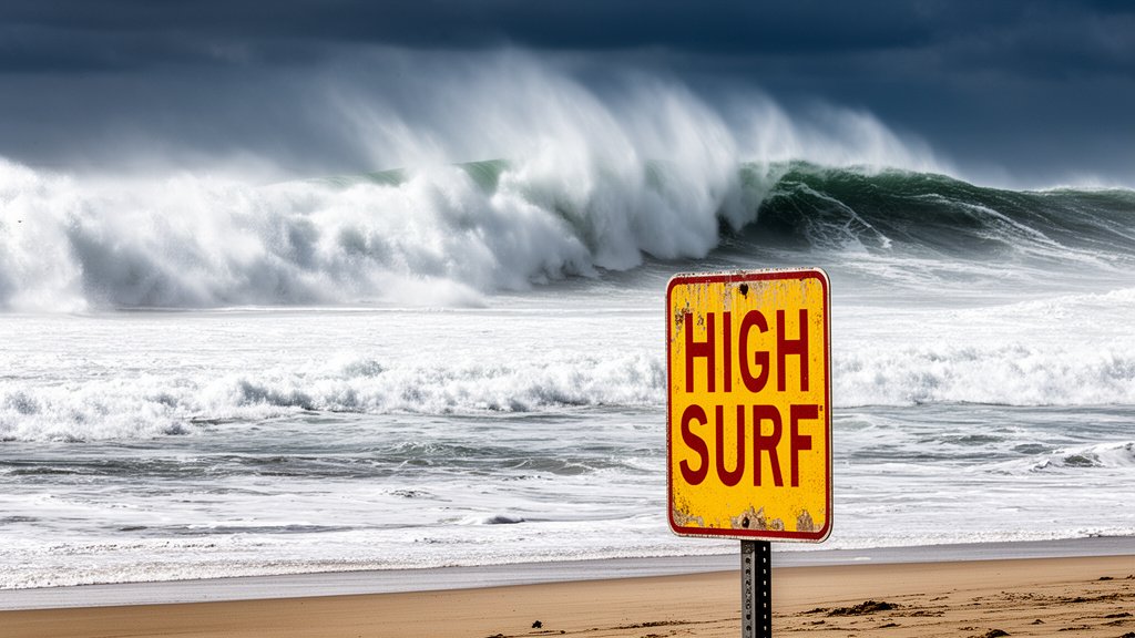
In preparation, municipal authorities are deploying additional lifeguard staffing and setting up “High Surf” signage at beach access points. Furthermore, parking lots adjacent to the shoreline in vulnerable zones are being monitored for flooding. In areas where severe erosion has been historically documented, such as certain stretches of the Ventura and Malibu coastlines, crews are on standby to clear sand and debris that may be pushed onto coastal roads by high-tide surges combined with the incoming swell.
Broader Climate Implications
This weather event serves as a stark reminder of the Pacific hurricane season’s volatility. The interaction between successive tropical systems and the North American coastline highlights the importance of real-time oceanic monitoring. As global sea surface temperatures fluctuate, the potential for tropical cyclones to maintain their intensity further north or persist longer in the season becomes a critical variable in long-range forecasting.
The economic impact of such events is also non-negligible. While the surf provides a spectacle for spectators, the closure of beaches, the interruption of local commerce, and the mobilization of emergency resources represent a significant fiscal undertaking for coastal municipalities. Moving forward, the integration of advanced satellite imagery and buoy data remains essential for predictive modeling, ensuring that the public remains informed well before the first sets reach the sand.
FAQ: People Also Ask
Q: How do distant hurricanes affect Southern California surf?
A: Distant hurricanes generate long-period waves (swells) that travel across the open ocean. Because these waves have a longer wavelength, they maintain their energy over vast distances and can reach the California coast with significant force, regardless of local weather conditions.
Q: What is the biggest danger for beachgoers during these conditions?
A: The primary danger is the presence of strong rip currents and the potential for “sneaker waves”—unexpectedly large waves that can pull unsuspecting people from the beach into the water. Swimmers should always prioritize lifeguard instructions and stay out of the water if flags or warnings are posted.
Q: How long will the high surf conditions last?
A: The duration of the high surf is determined by the speed and trajectory of the storm systems. With both Hurricane Polo and Hurricane Odalys contributing energy, the conditions are expected to remain elevated for several days until the storms lose their tropical characteristics or move out of the swell-generation window.
Q: Are evacuation orders likely for coastal residents?
A: While high surf advisories are common, evacuations are rare and typically reserved for extreme coastal flooding scenarios where storm surge compromises infrastructure. Residents should monitor local emergency management channels for official guidance.


Related Posts